Project
The project, which is addressed both to specialists and to the broader public, is the result of a collaboration between the Time Maps team from the National University of Arts of Bucharest and the International Center of Research of the Cucuteni Piatra-Neamț Culture of the Neamț County Museum Complex. The goal of this collaborative effort is to provide a tri-dimensional, virtual, realistic and credible image, of a prehistoric settlement, dating from the eneolitic (chalcolitic) period, belonging to the Cucuteni-Tripolye Culture, specific to the Moldovan SubCarpathian area, which represents the cradle of this brilliant continental civilization. This approach is based on archaeological data, the result of 130 years of specialized research, as well as etnografic data. Thus, the complete, broad range of information regarding the most important civilization of ancient Europe, is addressed.
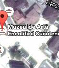
The settlement is hypothetically located in the Piatra-Neamț area, in the Cracău-Bistrița depression, where several museums host the greater part of the Cucuteni cultural heritage discovered on the current territory of Romania. The presence here of the International Center of Research of the Cucuteni Culture and the Cucuteni Eneolitic Art Musem (which preserves the most important collection of prehistoric art from Eastern Europe and the most important collection of cucutenian art in the world) is a strong argument in favor of this location selection, as part of the first complex attempt at virtual archaeology dedicated to the Cucuteni-Tripolye Culture.
As part of the proposed project a hypothetical settlement will be reconstructed, dating from the Cucuteni A phase (4500-4000 B.C.). The settlement is of small dimensions (approximately one hectare), and equipped with a fortification system. The reconstruction will include several surface buildings, thus presenting a great variety of functional and formal typologies (dwellings, annexes, workshops and sanctuaries) as well as different shapes (circular, rectangular) and dimensions (represented obviously at a reduced scale), positioned according to a pre-defined (circular) plan.
In the center of the settlement a distinctive building has been positioned, of a rectangular shape and larger dimensions, comprising a ground floor and an attic, and divided into three rooms, and whose interior is presented in detail. Thus, a series of interior design elements can be observed (hearth, oven, bench, case for the storage of grinding mills), as well as inventory objects (mainly ceramics), both for common and prestige usage,, specific to this civilization.
This project, very accessible in virtual space, provides a broad range of the public, in an engaging manner, some very important, general data regarding the layout and organization of space by Eneolitic human communities from the Eastern-Carpathian area, during the second half of the Vth millenium B.C..
